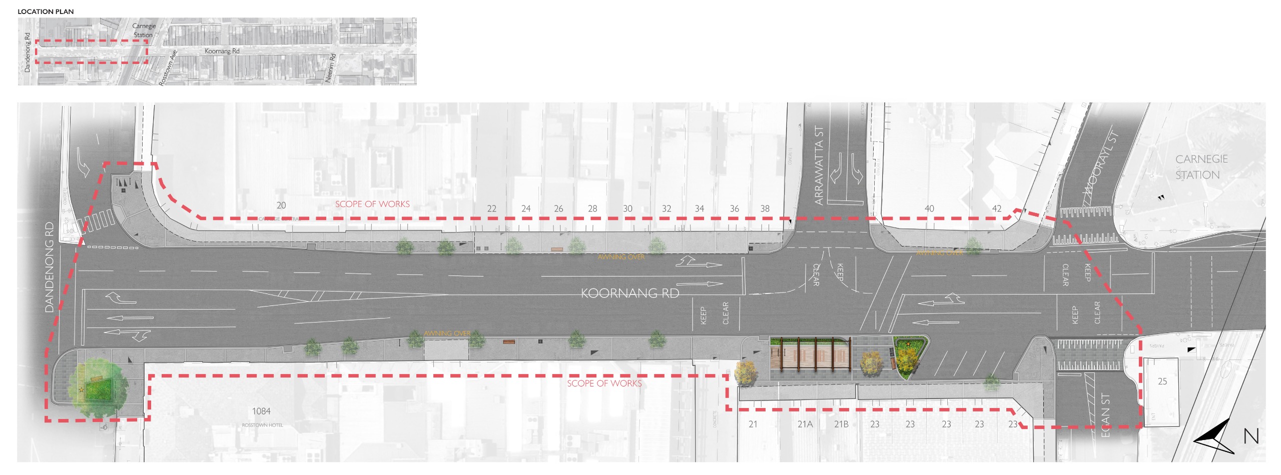
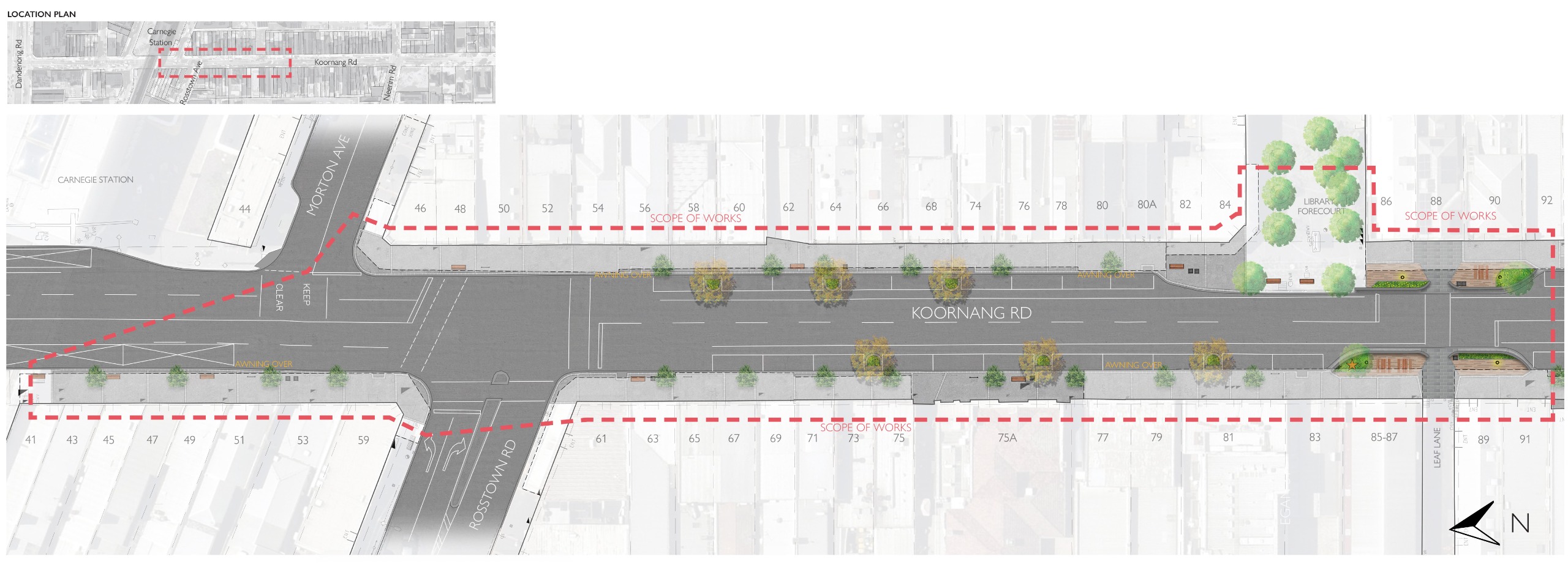
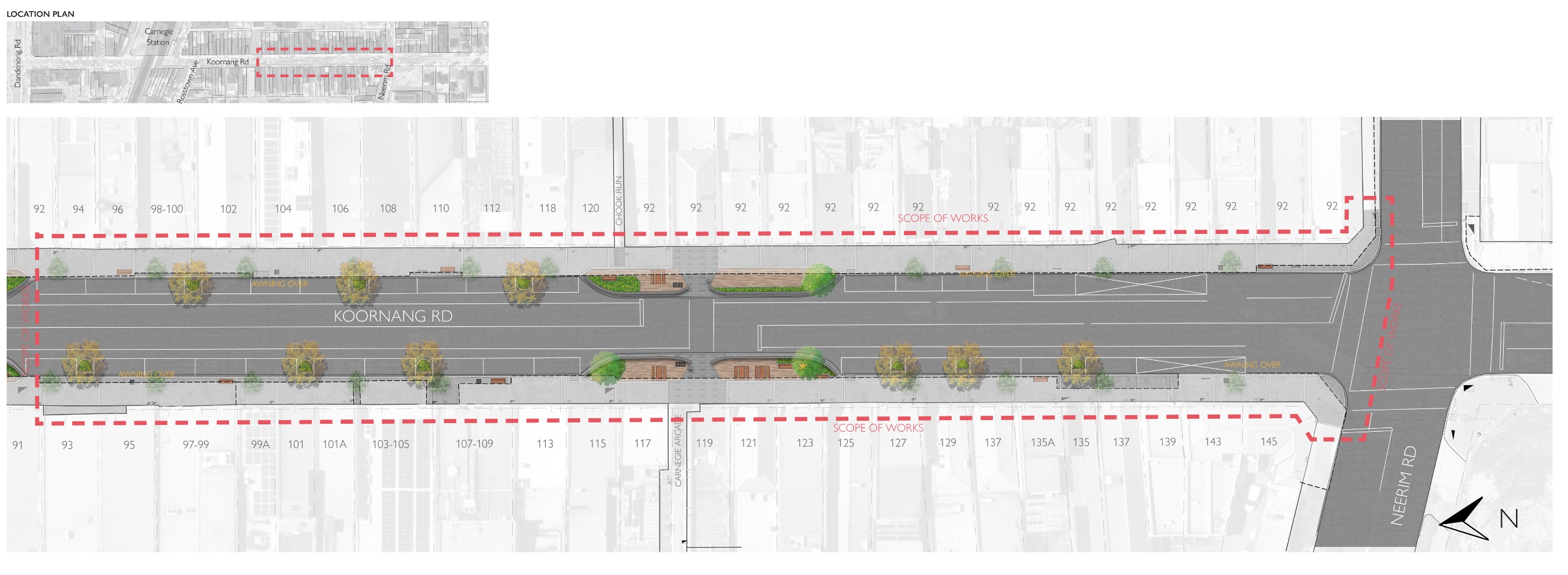
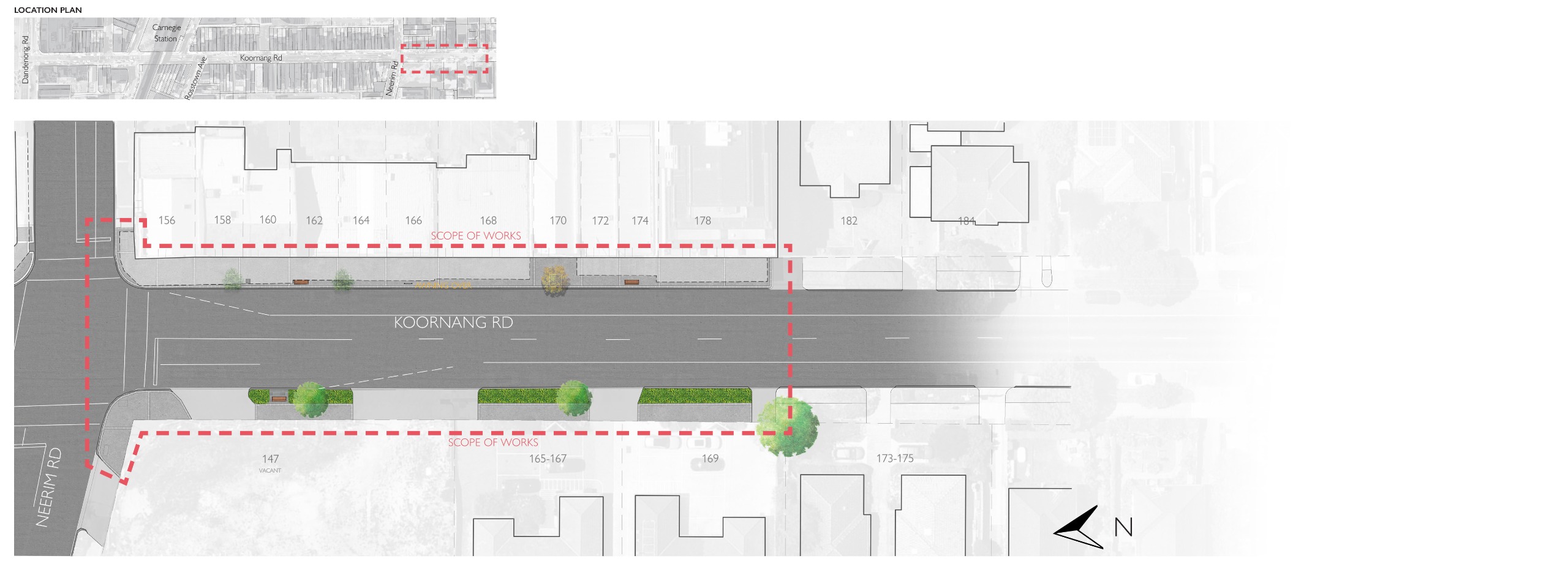
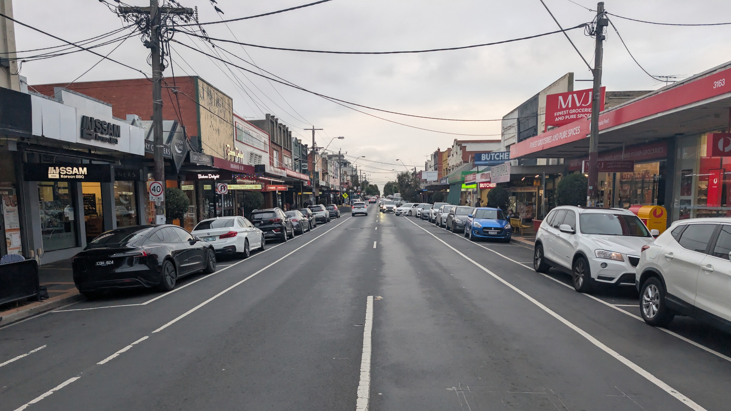
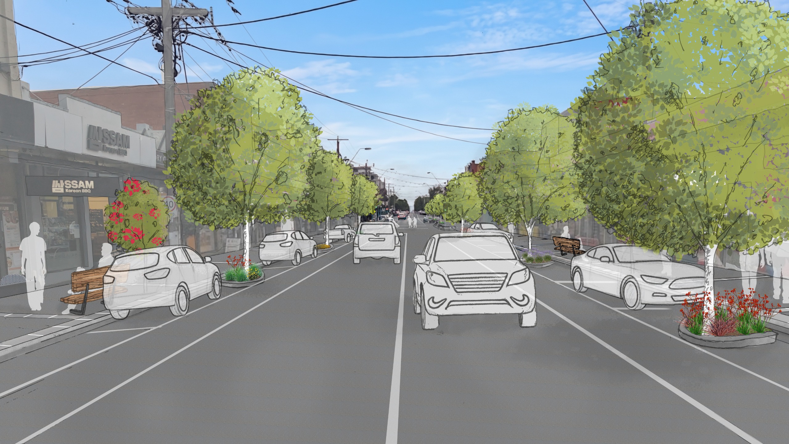
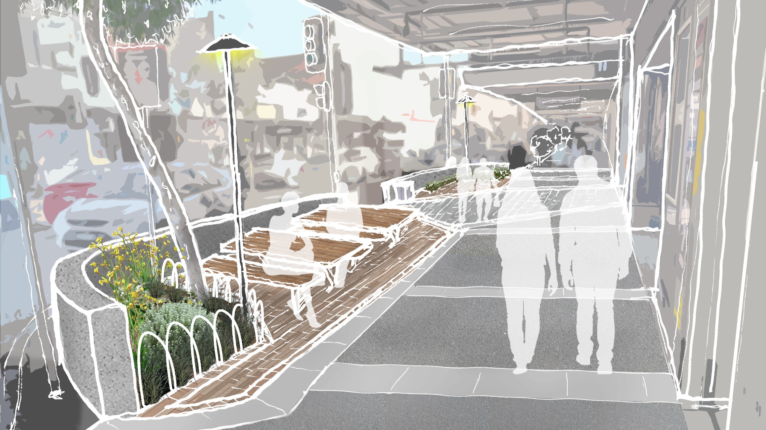
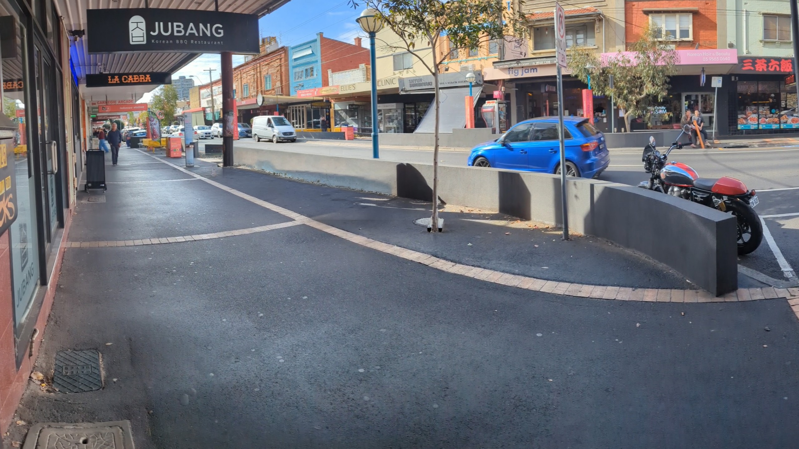
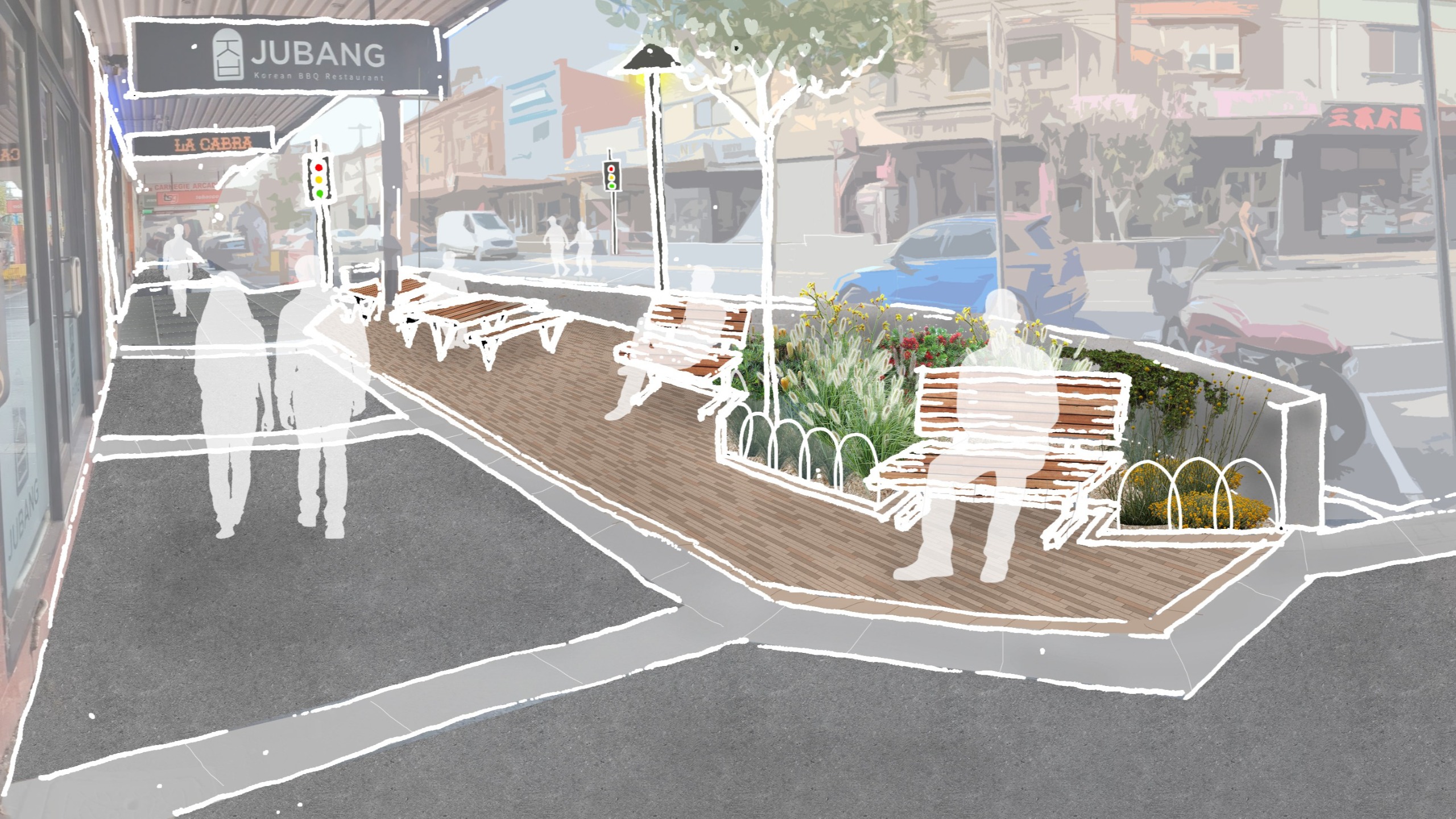
A new street design for Koornang Road

We’ve developed a draft Masterplan to upgrade Koornang Road, guided by the ideas, priorities and feedback you shared during our first round of engagement in June 2025.

Does the draft reflect what you told us? Share your thoughts to help us refine the Masterplan and make sure it delivers the changes the community wants to see.

Koornang Road is a key part of the Carnegie shopping strip, supporting local businesses, jobs, transport and community life. It has been identified as a high-priority area for streetscape improvements through the Better Streets, Better Places program.

This project aligns with Council’s Placemaking Strategy 2023–2027 and Council Plan 2025–2029, and supports the long-term vision set out in the Carnegie Structure Plan. Together, these plans guide improvements to create a safer, greener and more welcoming street for the community and local businesses.

Explore the Masterplan

Read the summary or explore the full draft Masterplan in the document library.

Share your feedback

This engagement is open from Monday 1 June to Sunday 28 June 2026, 11.59pm

What’s proposed

In the first round of engagement, we heard that the top priorities for Koornang Road were:

  • more garden beds and street trees
  • improved pedestrian safety
  • better footpaths and pavement

This feedback has directly informed the draft Masterplan, and the upgrades will be delivered in stages across coming years.

Select the tabs below to explore what's proposed for Koornang Road.

Key upgrades ✨

  • Greening and shade

    What's proposed

    • Within the footpath, the replacement of existing trees that are in poor health, with more trees planted overall.
    • On the road, the planting of 15 new large canopy trees within the parking lane to provide more shade (equivalent to about 3.5 tennis courts of canopy cover). This will require converting five car spaces, out of a total of 89 existing spaces
    • New garden beds along the street with colourful, low-growing native plants

  • Safer crossings

    What's proposed

    • A new signalised pedestrian crossing near Carnegie Arcade and Chook Run (subject to Victorian Government approval)
    • A raised pedestrian crossing at Egan Street to improve safety and comfort
  • Footpaths and street layout

    What's proposed

    • New footpath paving along both sides of Koornang Road (about 650 metres in total)
    • Wider and more accessible parking bays, without reducing overall parking numbers
  • Seating, lighting and public spaces

    What's proposed

    • New street furniture, including benches, bins, bike hoops and picnic tables, using a consistent, high-quality design
    • Upgrades to three key gathering places near pedestrian crossings with new seating, lighting, garden beds, feature paving and public art
    • Improved feature lighting at key crossing points
  • Other improvements

    What's proposed

    • Better wayfinding signage and opportunities to share local stories
    • Providing space for public artwork at regular intervals along the street
    • Improved stormwater management to better capture and manage rainwater

Interactive map 📍

The project area covers Koornang Road, Carnegie, between Dandenong Road and south of Neerim Road.

The draft Masterplan is shown across four key precincts:

  • Northern Precinct — Dandenong Road to Carnegie Station
  • Central Precinct (Part 1) — Carnegie Station to the pedestrian crossing
  • Central Precinct (Part 2) — Pedestrian crossing to Neerim Road
  • Southern Precinct — South of Neerim Road

Click on the glowing hotspots to explore the proposed changes in each location.

Click on the arrows to enlarge the maps.

Northern Precinct — Dandenong Road to Carnegie Station

Central Precinct (Part 1) — Carnegie Station to Pedestrian Crossing

Central Precinct (Part 2) — Pedestrian Crossing to Neerim Road

Southern Precinct — South of Neerim Road

Before ➡️ After

'In-road' canopy trees

We’re proposing to plant 15 new large canopy trees within the parking lane to provide more shade. This is equivalent to about 3.5 tennis courts of canopy cover. It will require the conversion of five car spaces, out of a total of 89 existing spaces along Koornang Road.

Before After

Library and Leaf Lane Crossing

The pedestrian crossing point opposite Leaf Lane and the Library forecourt is the busiest crossing on Koornang Rd. Upgrades will widen seating areas and add new paving, timber seats, garden beds and lighting — improving comfort while maintaining this primary connection point over Koornang Road.

Before After

Southern crossing (north of Neerim Road)

Unsafe crossing is the key issue at this location. In-principle support has been given for pedestrian-operated traffic signals — and other upgrades will include new paving, expanded seating and gathering space, garden beds, upgraded bins and bike hoops, public art opportunities, and improved lighting.

Before After

Share your feedback by Sunday 28 June 2026.

For more information, see the Frequently Asked Questions.

You can also request a hard copy of the survey form to be posted to you.  To request this, contact us at (03) 9524 3333 or email us at engagement@gleneira.vic.gov.au.

Quick Poll ⏲️

In the first round of engagement, we heard that improving pedestrian safety and crossing points, introducing more trees, greenery and shade, and upgrading footpaths and paving were the top priorities for Koornang Road.
Overall, how well does the draft Masterplan reflect the community priorities identified during phase one engagement?

​Privacy collection notice

Glen Eira City Council is committed to protecting the personal information provided by you in accordance with the principles of the Privacy and Data Protection Act 2014 (Vic). The privacy collection notice explains the purpose for which information is collected, and how we will use and handle the information. You can view the privacy collection notice for this project here: Privacy Collection Notice.